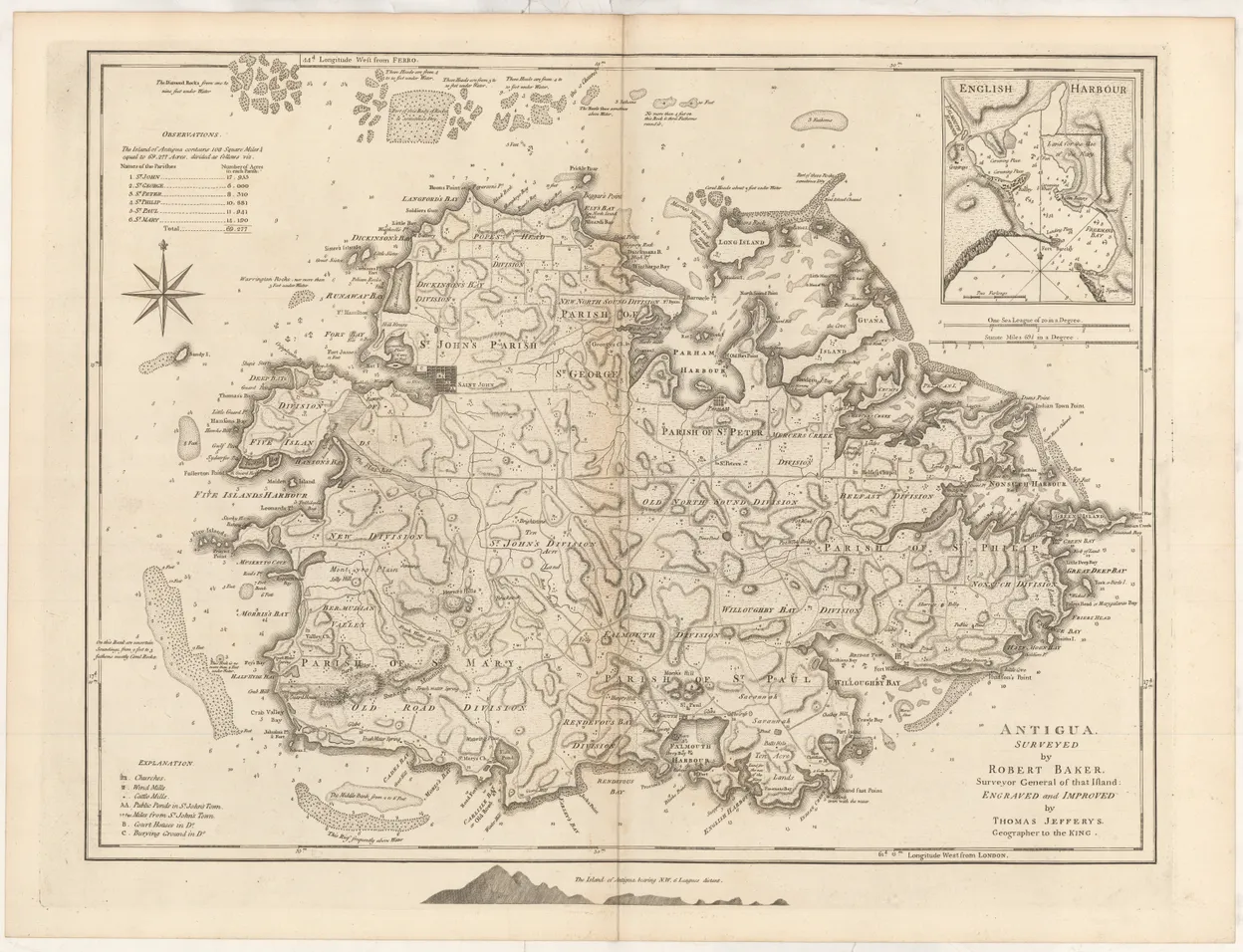
[BAKER (Robert)].
Antigua surveyed by Robert Baker Surveyor General of that island, engraved and improved by Thomas Jefferys ...
Double-page engraved map. [London : Robert Sayer and John Bennett], 1775.
Double-page engraved map. [London : Robert Sayer and John Bennett], 1775.
Scarce map of the island of Antigua. The original survey was performed by Robert Bayer, Surveyor General of the island from 1746 to 1748, and published as a wall-map, on four sheets, in 1749. Baker's survey remained the standard delineation of the island for the next thirty years. The wall map is a rarity.
This derivative was edited by Thomas Jefferys, Geographer to the King, for inclusion in his projected West India Atlas, published posthumously by Sayer and Bennett in 1775, forming the standard British atlas of the region throughout the American Revolutionary War.
The map includes a detailed chart of English Harbour, with its anchorages.
This is a fine example, on good paper, with wide margins and a dark impression.