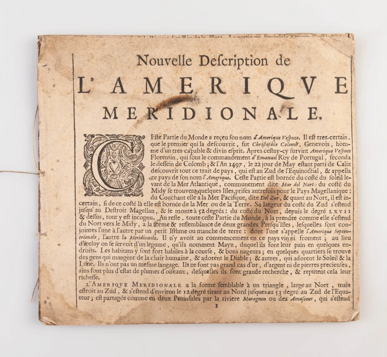
A rare and unlikely survival. These nine descriptive sheets were issued to accompany Blaeu's Americae Nova Tabula. The sheets were to be laid down along the border of the map and provided historical and topographical information for the map in question.
The text appears to have been written specifically for this map, rather than being lifted from elsewhere, and has been updated to 1637. They would've been made available right away, even though the next (fourth) state of the map wasn't published until 1642. The sheets commence with a brief history of discovery - Columbus in 1497 - and some rather basic geography, before going into detail on each of Brasil, Chile, Peru, Guyana, Castille d'Or (Colombia/Panama), Terre Ferme (Venezuela), Veragua (Costa Rica) and Honduras. There are notes on Indigenous populations as well as natural history and topography.
The final sheet concludes on a commercial note: "Et cecy sussira de l'Amerique Meridionale, qui en désire davantage, se peut servir du Nouvel Atlas, mis en lumiere par G & I Blaeu." The Nouvel Atlas was first published in 1634, with issues in Dutch, German and Latin as well as French. Johannes succeded his father as Hydrographer to the Dutch East India Company (V.O.C.) in 1633. Willem Blaeu died in 1638, after which his sons contined the firm together.
An example of similar sheets in situ can be seen here: https://collections.leventhalmap.org/search/commonwealth:x633f911p