Commodore Matthew Calbraith Perry (1794-1858) was commissioned by the US Navy to force Japan to open its ports to American trade. Many Western nations had attempted to open negotiations with Japan before, but only the Dutch managed to trade under tightly controlled conditions at Nagasaki. The Americans saw an opportunity after signing the Treaty of Wanghia with the Qing government on July 3rd, 1844. In the following year Congress authorised Commodore James Biddle (1783-1848) to sail to Japan in order to open negotiations with the Shogunate. They arrived at Uraga Bay on July 20th, 1846, but his attempts were rebuffed.
Seven years later, on July 8, 1853, Perry was back in Uraga Bay, this time accompanied by four war-ships, namely the USS Mississippi (the flag ship), the Susquehanna, the Plymouth, and the Saratoga. He delivered a message by the American President Fillmore demanding the opening of Japan, while giving the Shogun one year in which to sign a treaty with the US. It was only on the 7th day after the arrival of the fleet (July 14th) that Perry was allowed to go ashore at Reception Bay (Kurihama) with an entourage of 320 men in order to present President Fillmore's demands to the Shogunate's government representatives.
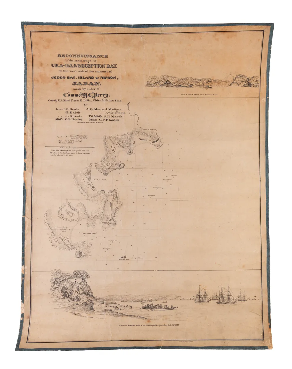
Since Perry knew that he was going to be back in Japanese waters in the following year he made great efforts to survey the coast and the waters around Uraga Bay, even entering the mouth of Edo Bay. The present chart was prepared by Lieut. S. Bent, G. Balch, J. Guest and five other officers. Stretching from Cape Kama Saki at the entrance to Edo Bay to Morrison Bluff with its military fortifications, it provides a survey of Uraga Bay and the adjacent so-called 'Reception Bay' at Gora-Hama (Kurihama). Japanese troop strength are indicated with black dashes together with cannon batteries, while the topography is shown in simple relief. Depth soundings are added throughout the coastal waters as well as the positions of the four 'Black Ships' (kurofune) anchored in a row in front of Uraga, also taking account of the subsequent move of the USS Mississippi, and the Susquehanna towards 'Reception Bay'. Two sketches by William Heine and Eliphalet M. Brown are added in the upper and lower margins. The top one is entitled "View of Ura-ga Harbor from Monument Point" showing the coastline with a cannon fortification and Mt. Fuji in the distance. The panoramic view at the bottom is entitled “View from Morrison Bluff of the Landing in Reception Bay, July 14th 1853”. It records the momentous occasion of Perry first landing at Kurihama Bay. To the right is a fortress carved into the cliff face, the foreground shows two barges carrying Japanese envoys towards the US fleet while in the background one can make out a small fleet of American rowing boats making their way towards the beach. On the surface the view has an aura of calm. In fact, both the Americans and the Japanese were in a state of highest tension, suspecting each other of treachery at any given moment. "When the two steamers had anchored the two government boats came alongside. "When the flag was raised, Kayama, accompanied by Hori and Tateishi, came on board from the first boat, and was followed shortly after by Nakajima, who had not been aboard since the first day." The 320 Americans were vastly outnumbered by Japanese troops estimated between 5-10,000 men. This lower drawing thus combines several timeframes, and indeed features all of the four American warships when in fact only two were present at the landing at Kurihama.
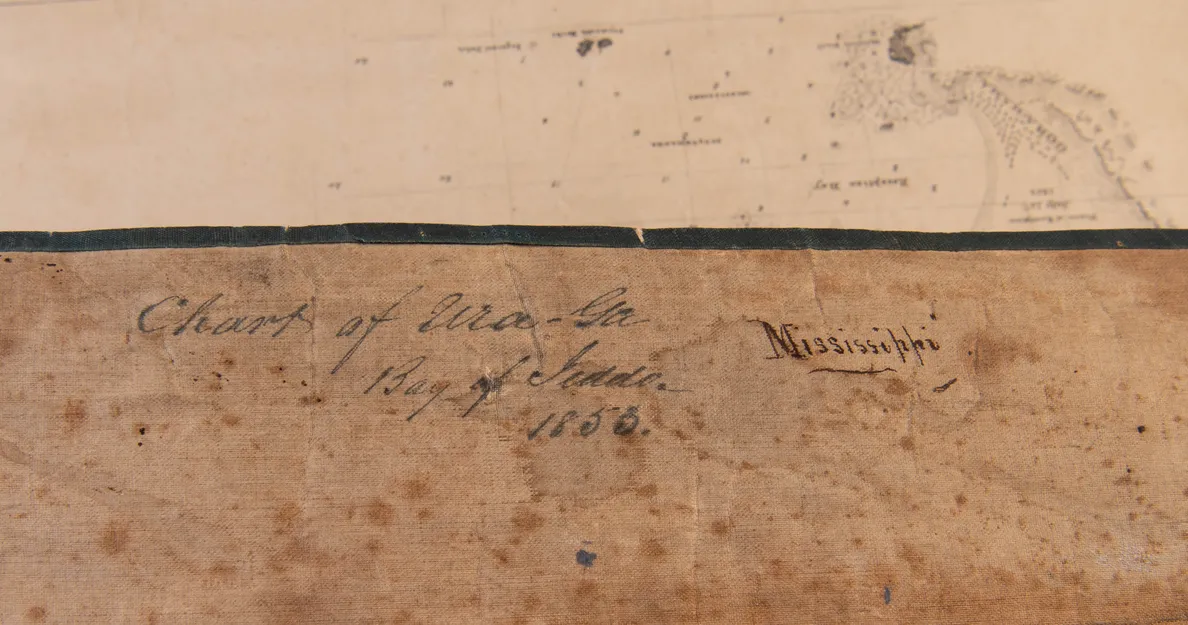
We can find only one other identical example of this chart in the U.S. National Archives. <https://catalog.archives.gov/id/102278572> Our views carries a delicate inscription “Traced by H. Patterson Sep 5, 1853” in the lower margin. It would appear that the assistant draughtsman Hamilton Patterson made a copy of the chart, and according to the contemporary inscription on verso, ours was for the use aboard USS Mississippi, the flagship of Perry's force.
See: PINEAU (Roger), editor: The Japan Expedition 1852-1854 – The personal Journal of Commodore Matthew C. Perry. Washington, Smithsonian Institution Press, 1968, pp. 165-166.