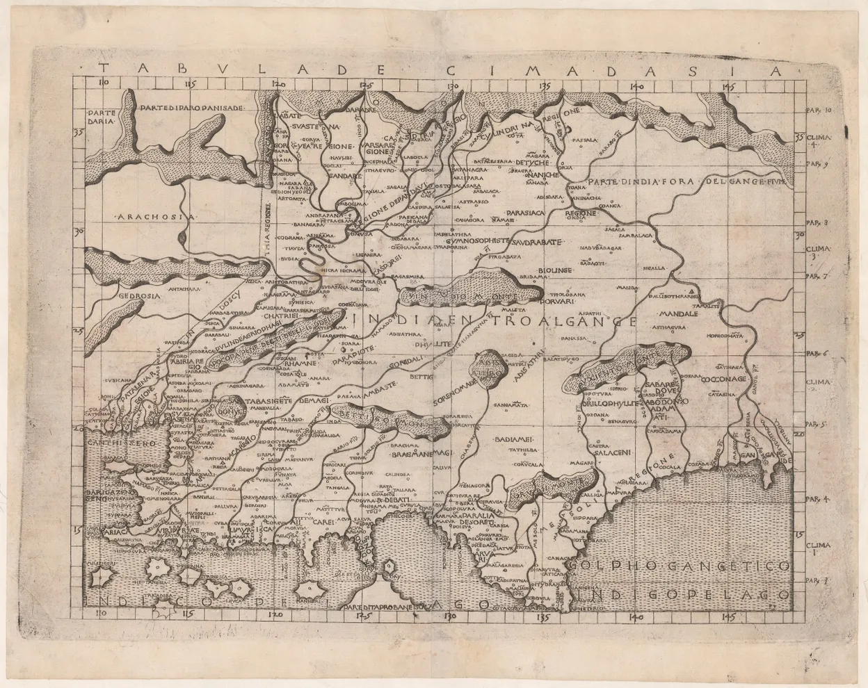
A nice example of Berlinghieri's Ptolemaic map of the Indian subcontinent to the west of the Ganges, including parts of modern-day Pakistan, Afghanistan and eastern Iran. It is the third engraved map of the region.
Francesco di Niccolo Berlinghieri completed the Septe Giornate della Geografia in about 1479, as a paraphrase of Ptolemy's geographical text in Italian verse, in which he combined classical and contemporary texts; he illustrated the text with thirty-one maps, twenty-seven based on Ptolemy, with four modern maps. The volume was printed in 1482, and is regarded as the third printed atlas of the world, after the 1477 Bologna and 1478 Rome editions.
This Ptolemaic map of India is drawn on Marinus' plane projection; as such it is the only one of the early Ptolemaic maps to be drawn on his original projection, with equidistant meridians and parallels.
This example appears to be from the third issue (sometimes called the second edition), circa 1520-25, but all printings are rare. We can assert this due to recent research by Peerlings and Laurentius (Berlinghieri’s Geography Unveiled, 2003) which has identified subtle amendments to the plates, pointing to the existence of different states of the maps. Peerlings and Laurentius identify two distinct states of Tabula Decima dAsia, of which this is clearly the second.
References: Campbell, Earliest Printed Maps, 176; Laurentius and Peerlings, pp.187-188.