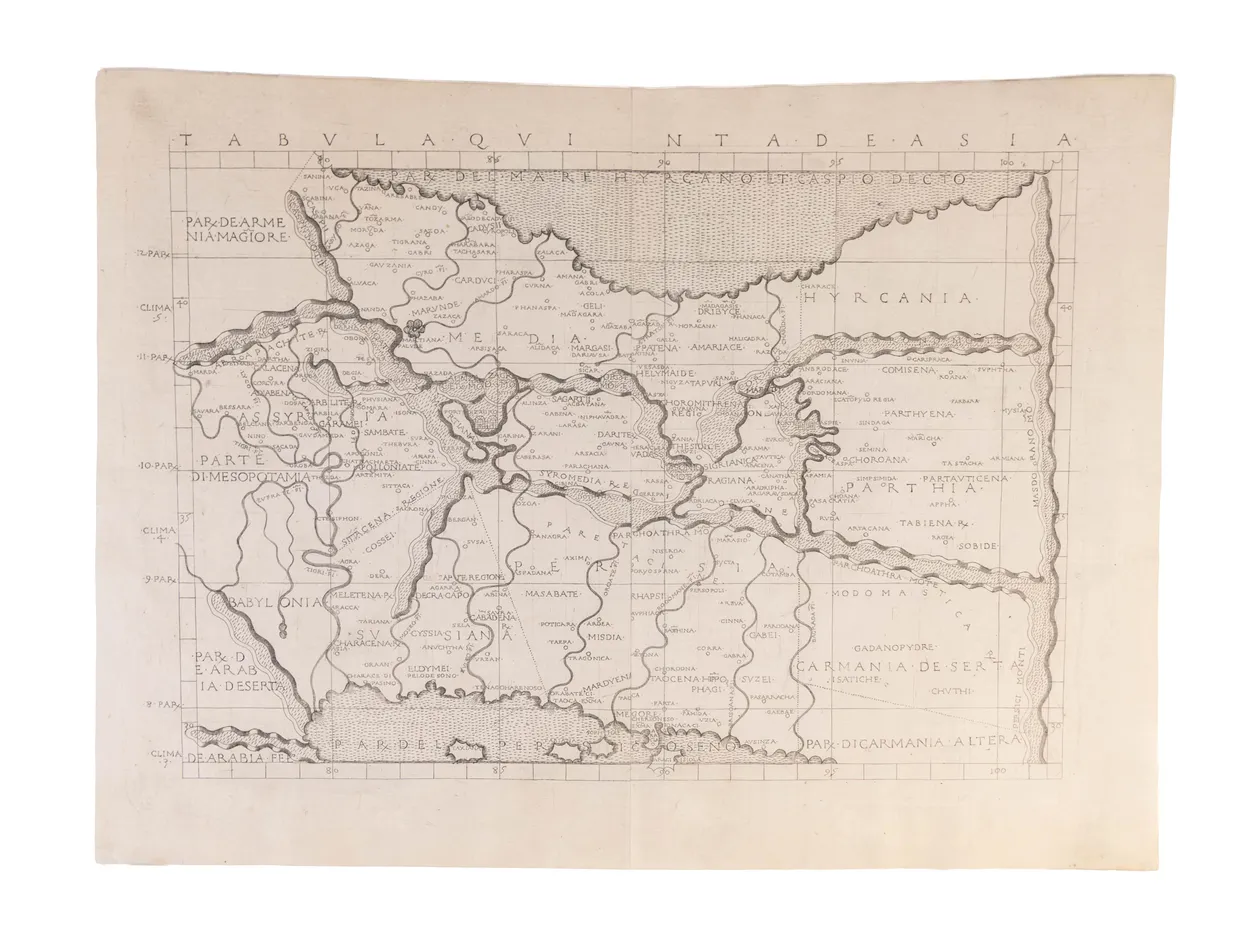
An excellent example of the third engraved map of Persia (modern-day Iran), from Berlinghieri's celebrated atlas.
Francesco di Niccolo Berlinghieri completed the Septe Giornate della Geografia in about 1479, as a paraphrase of Ptolemy's geographical text in Italian verse, in which he combined classical and contemporary texts; he illustrated the text with thirty-one maps, twenty-seven based on Ptolemy, with four modern maps. The volume was printed in 1482, and is regarded as the third printed atlas of the world, after the 1477 Bologna and 1478 Rome editions. Maps from the 1477 atlas are so rare as to be unobtainable, leaving this as the second oldest engraved map of Persia acquirable by a collector.
This Ptolemaic map of Persia is drawn on Marinus' plane projection; as such it is the only one of the early Ptolemaic maps to be drawn on his original projection, with equidistant meridians and parallels.
This example is from the first or second issue of the atlas, printed in 1482. We can assert this due to recent research by Peerlings and Laurentius (Berlinghieri's Geography Unveiled, 2003) which has identified subtle amendments to the plates, pointing to the existence of different states of the maps. For Tabula Quinta de Asia, Peerlings and Laurentius identify two distinct states (p.184-185), which can be distinguished by the over-printing of one letter in a single regional toponym near the centrefold: SAGARTII or SAGAREII. SAGARTII indicates the first state, and SAGAREII (with the ‘E’ overprinted) marks the second state.
Complete atlases of any issue are scarce and individual maps are decidedly rare: "It is also said that these maps were sometimes sold separately, or in sets without text. I've hardly ever come across single examples and only once a set" (Wardington Catalogue).
Campbell, Earliest Printed Maps, 171.