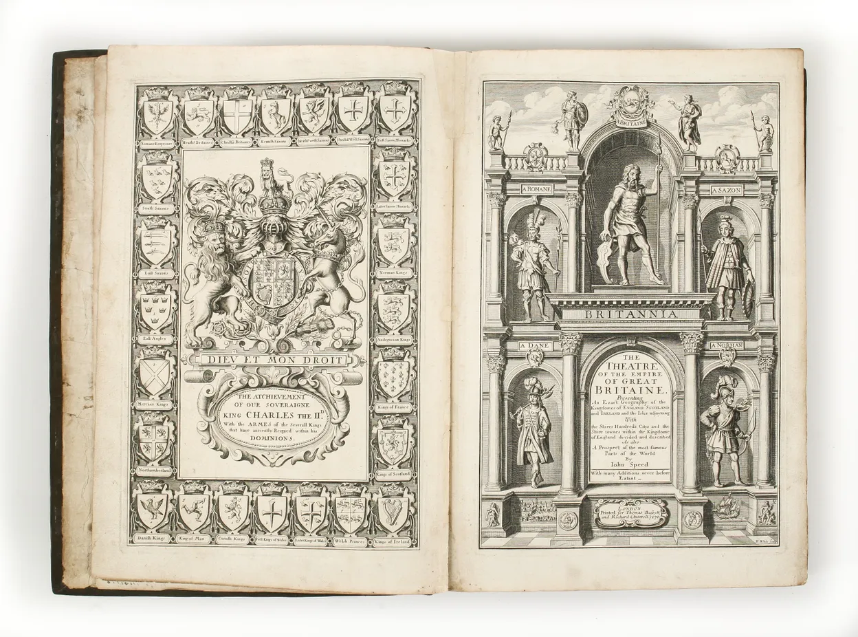
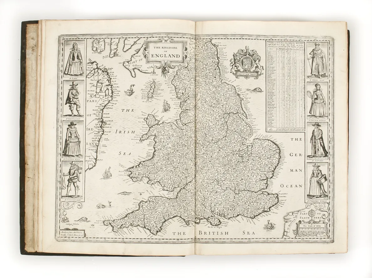
Speed’s Theatre, published in 1612, was the first printed atlas of the British Isles. It was the first large format atlas with individual maps of the English and Welsh counties and, by virtue of the many insets, can lay claim to be the first printed collection of British town plans. Speed, by inclination, was an antiquarian rather than mapmaker. The maps are decorated to reflect these interests, with the arms of leading nobles, engravings of antiquities and coins, and so on, as well as the inset plans and views. The maps of Oxford and Cambridge bear the arms of the colleges and Lancashire portraits of the Kings and Queens of the rival Lancastrian and Yorkist families.
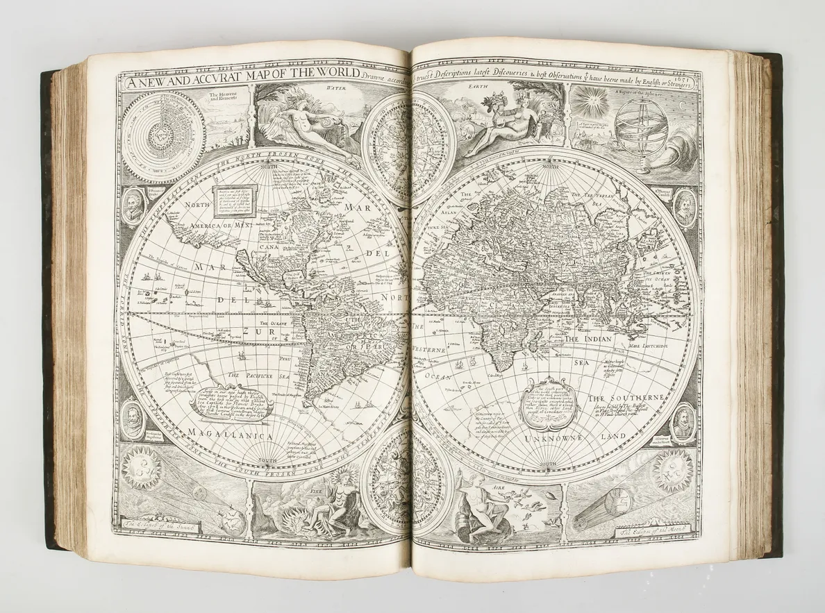
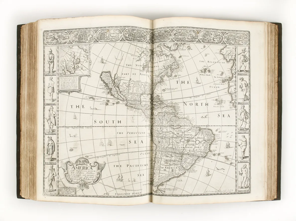
The Prospect is considered the first world atlas assembled and published by an Englishman, even if the model was Dutch and the engraving was performed by Dutch craftsmen in Amsterdam. The Prospect was published in 1627. The maps are generally flanked with costume figures of local men and women, while the World map has elaborate allegorical vignettes of the four seasons, portraits of famous mariners and scientific diagrams. The most significant maps for an English audience were the America, which marks the early English settlements along the Virginia, New England and New York coastlines, and a very early map of the English colony of Bermuda.
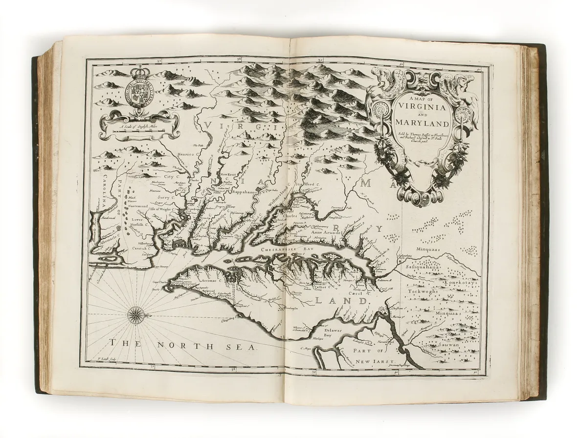
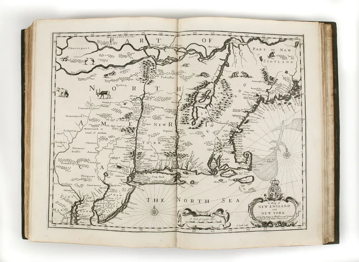
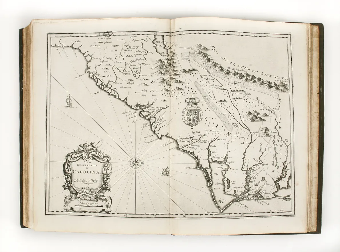
The two atlases were much reprinted; the plates were acquired by Thomas Basset and Richard Chiswell in about 1674, whereupon they commissioned new text and maps, to bring the atlas up to date, including four relating to English America: New England, Virginia and Maryland, the Carolinas, and a map-sheet with Jamaica and Barbados. The two other new maps were of Russia and of South-East Asia with the East Indies; making its first appearance, but printed from an existing plate from 1611, was a map of the Holy Land.
Visually, Speed’s are among the finest English atlases; the individual maps are highly sought after for their beauty, but it is only in the complete volume that one can understand the scale of Speed’s achievement. These additions, with the broadened world-view, make this the most important of the many editions and one of the great English atlases and geographies.